


Full View
Panašūs daiktai
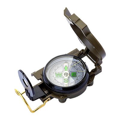
Plastic Army Green Flip Cover Portable Camping Outdoor Climbing Compass
227 parduota
€16.72€22.33
numatytasis : numatytas

Kiekis :

Pranešimas
Įtraukite autorių teisių pažeidimąNemokamas standartinis pristatymas. Žr. išsamią informaciją
Apskaičiuota tarp Sat, Oct 18 ir Sat, Oct 25
Prekę galite grąžinti per 30 dienų nuo gavimo. Žr. išsamią informaciją
Pirkite su pasitikėjimu

Pinigų grąžinimo garantija
Grąžinkite užsakytą prekę arba pinigus. Sužinokite daugiau
About this item
Seller assumes all responsibility for this listing.Prekės numeris: 30790560
Item specifics
Item description from the seller
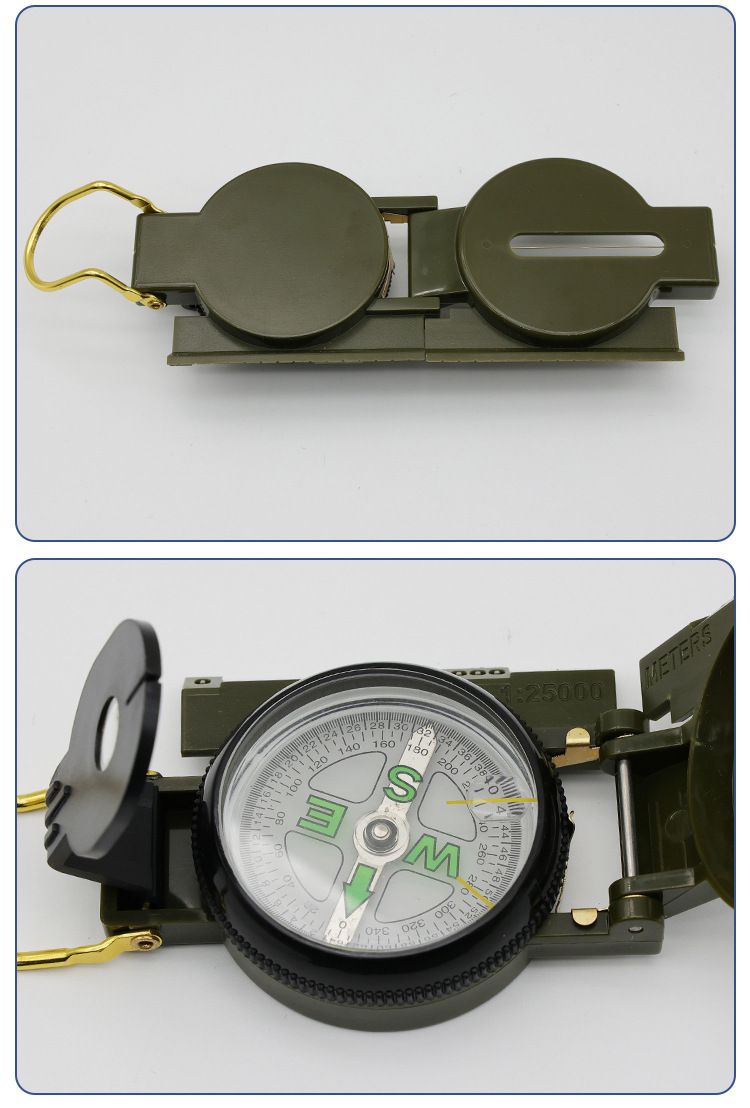
How to Use the Multifunctional Compass
(1) Determine the Orientation:
1. Determine the local southeast and northwest directions
(1) Open the compass to set the azimuth indicator△Align to 0;
(2) Rotate the compass until the magnetic needle points to the north end and aligns with 0. The direction it points to is north, and you can directly read the east, south, west, and north directions on the azimuth glass.
2. Calibrate to the nearest thousandth
Calibrating map orientation involves using a compass to align the map's orientation with the actual location.
(1) Turn on the instrument and adjust the dial base so that the azimuth indicator△Align to 0;
(2) Use a surveyor's tape to align with the true meridian on the map;
(3) Rotate the map so that the north end of the magnetic needle points to the value of the magnetic declination in this region, then the orientation on the map will be completely consistent with the current location.
3. Determine the magnetic azimuth angle
A. Determine the magnetic azimuth angle of the target on the map
(1) Use a compass to calibrate the map and keep it stationary
(2) Make the surveying tape perpendicular to the line connecting the reference point and the target point, adjust the dial base so that the indicator..△Align with the zero mark
(3) After the magnetic needle comes to rest, the scale on the dial base pointed by its north end indicates the magnetic azimuth angle value from the starting point to the target point.
B. Determine the magnetic azimuth angle of the target on-site
(1) Turn on the instrument and align the slot indicator△Align it to 0 and make sure the reflector is slightly at a 45-degree angle with the dial base
(2) Insert your thumb into the lifting ring, hold the instrument flat, and aim at the target using the sight and crosshair
(3) Look at the magnetic needle from the reflector at the alignment on the dial base, which is the magnetic azimuth angle value for the target on-site
Box size 40.5*26*28.5CM, one box contains 144 pieces, weight 13KG


 4.3 iš 5, remiantis 6,260 atsiliepimais